Wishing you all a Very Merry Christmas.
Showing posts with label Mountains. Show all posts
Thursday, December 24, 2015
Wednesday, June 10, 2015
Carving gullies
I drove through Wind River Canyon again, after the flash flooding carved deep gullies in the steep canyon walls and pushed huge rocks onto the road. That event was a good two weeks ago, and heavy machinery is still working on the road and railroad, moving dirt and breaking up car-sized rocks. Perhaps you can see in the background that the traffic is stopped on the highway; I suppose we waited a good 15 minutes.
The gullies are big on both sides of the road. It must have been a spectacular sight to see this event ... that is, from a safe distance.
Wednesday, June 3, 2015
Tuesday, June 2, 2015
Rushing muddy waters
Monday, June 1, 2015
Tracks in the mud
A dear family friend who lives in the southwestern part of the state was up here for a visit and asked if I would like to go along on a ride up to Sheridan Creek above Dubois. I'm always up for a ride in the mountains; every trip offers something new and beautiful. My friend wanted to visit the area where her folks' ashes had been scattered and lay out some flowers as a Memorial Day tribute.
Nearby is this towering tree, with this exposed root system (below). How does it survive?
After enjoying the peace and beauty in this campground area, we started walking around, first down to the creek. The water was rushing and pretty muddy in color; the main stream is in the background, and the overflow is in the foreground.
Then, we walked toward the road and planned to walk to the bridge - another nice place to snap photos.
As we were about to step on to the road, I noticed something pretty obvious... fresh tracks that were not from a moose, an elk, or a deer. No sirreeeee!
We both thought these tracks looked particularly FRESH. Soooo, how about a few pictures? And, perhaps NOT continue on to the bridge, just in case momma griz and the cub are interested in lunch...or have had a bad morning...
After walking back to the car, we decided it would be safe to DRIVE up the road, wondering if we'd see the bears. But we didn't. All that we saw were more tracks in the mud. Just for comparison, take a look at my size 10's compared to momma bear's paw print.
Wednesday, April 8, 2015
A Sunday drive
I like to make a trek to The Sinks when the spring run-off is in full swing, but I made the drive with a friend over the weekend, and we saw that the melting snow was just beginning to rush down the river.
In the above photo, you are looking up river, and the water flows around to the left and makes a big curve, as it flows into a cavern.
From deep in the cavern, it is actually a mystery as to what happens to the flow, but the best guess that researchers have made is that the water goes underground into quite a large reservoir before rising above ground about a mile down the hill, at the "Rise of the Sinks."
When the spring run-off is at its peak, most all of these rocks are covered in roaring, foaming water, and the top of the cavern is barely visible. See the "white" around the pine trees? Yes, that's snow.
Tuesday, August 5, 2014
A ride out to Pinion Ridge
The weekend opened up another opportunity for a 4-wheeler ride...this time to Pinion Ridge on top of Union Pass. We rode 37 miles, round trip. Much of it was in beautiful timber. The higher in altitude we climbed, the more wildflowers we saw; we especially admired the Indian Paintbrush, which was particulary vibrant.
We rode on, until finally the trail climbed a hill, a grassy slope above the timber. Here is where the view opens up and treats you to quite a great view of Green River Lake and the Wind River Mountains as you look to the east.
Here we are at the trail's end. If you look over your shoulder to the west, you can see the Grand Tetons, and to the north, the Pinnacles. It's a grand view! A haze was moving in and out of the valley, and the sunlight was changing constantly. It was difficult to capture a good image, but we sure enjoyed the view as we ate a late lunch on top of the mountain.
Driving back down the Union Pass Road, we found a field of purple flowers. Time for a final photo shoot. The sky was looking pretty dramatic too.
We rode on, until finally the trail climbed a hill, a grassy slope above the timber. Here is where the view opens up and treats you to quite a great view of Green River Lake and the Wind River Mountains as you look to the east.
Here we are at the trail's end. If you look over your shoulder to the west, you can see the Grand Tetons, and to the north, the Pinnacles. It's a grand view! A haze was moving in and out of the valley, and the sunlight was changing constantly. It was difficult to capture a good image, but we sure enjoyed the view as we ate a late lunch on top of the mountain.
Driving back down the Union Pass Road, we found a field of purple flowers. Time for a final photo shoot. The sky was looking pretty dramatic too.
Tuesday, August 20, 2013
Under the Ramshorn
I was at an elevation of 9,395 ft. looking up at Ramshorn Peak (11,635 ft) from the Burroughs Creek Loop Trail. What a view from here. Yes, I could even see the Grand Tetons, even though smoke from forest fires had swept into the area. They were too faint to show up in my camera, so I zeroed in on a closer, jagged ridge instead.
Wednesday, August 14, 2013
Red Rocks
So often I have taken a picture of the Red Rocks near Dubois as I've traveled, looking west. But on my last trip, a few days ago, I stopped to take a picture, looking east. It's a rather remarkable view!
Thursday, June 27, 2013
Wednesday, September 12, 2012
New Rider...New Trails
It is fun to explore new trails on a 4-wheeler, but it’s
equally as fun to take someone new on a 4-wheeler ride in the mountains. So, here was Nancy S’s first ride, and she
did very well! We took it easy, stopped for pictures, explored some trails, and
enjoyed the fine weather.
![]() |
| Here's Nancy S. snapping photos of the devastation left by a forest fire a few years ago. |
Glenn and Cheryl were part of the crew too, and they led the
excursion in their side-by-side Polaris RZR; I brought up the tail end. We were in the Union Pass area, and I had not
approached Fish Lake from the Sheridan Creek Road, so that section was new to
me. I’m always interested in new trails! We stopped for about 30 minutes at Fish
Lake, located very near the continental divide. The breezes swept across this small lake and
kept us cool while we sat on a sunny hill on the north shore to eat lunch.
![]() |
| Fish Lake |
On our way back, Glenn was willing to take us down two
different roads that branched off the Sheridan Creek Road. Both were new to me. The first one had a roadblock where a bridge
must have been taken out, so we were not able to continue to the trail's end. The second road led us in to Pellam Lake. The last quarter-mile was rough, so Nancy S.
parked her machine and rode with me on my 4-wheeler as we followed Glenn and
Cheryl.
![]() |
| Here is a section of the road as we approached Pellam Lake. |
Yeehaw! Nancy got a taste of a more difficult
4-wheeler ride, rolling over a maze of boulders, tree roots, and gullies. What
a great sight as we approached the lake.
Although it’s a destination for many fishermen, today we were the only
ones there. It was peaceful and
beautiful, tucked in at the base of Lava Mountain.
![]() |
| We posed for the self-timer camera: Me, Nancy S., Glenn, and Cheryl |
Monday, September 10, 2012
Seven Lakes Trail
Day 3 of the Labor Day Mountain-Trail-a-Thon
That “early” start for the day was working well for us. So, another leisurely breakfast was prepared
and thoroughly enjoyed, as my bro made a mean skillet of scrambled eggs. Hard to believe we even had an appetite after
the ton of grilled shrimp we ate the night before. Conversation led to the idea that if we were
a tribe, we’d probably be called the “Shrimp Eaters.” Taking it a step further, we’d each be given
Indian names too. Contemplating the
possibilities, my brother suggested that his friend’s name would have to be
Chief Questionable Judgment, based on his experience with him on an earlier
epic motorcycle ride. After a hearty
chuckle, the tribe voted unanimously in favor of the title and vowed to honor
the lead of Chief Q J! We didn’t get around to other names, but my brother’s
might be Stands Close to Grill, or Follows Close Behind. Mine might be Talks Too
Much or Bounces Over Boulders… We’ll have to leave that discussion for another
rendezvous.
At 10:30 a.m. the guys got to work on the brake line of my
brother’s motorcycle. It appeared the welding job worked, but after bleeding
the line, the brake fluid wasn’t filling the tube as it should. I have to hand it to the guys for persevering
and problem solving until it was fixed.
And, it appeared that the front brake was again operational! My brother asked, “Is it too late to head out
for another ride?” I replied, “No,
it’s not too late! We can still make a trip.”
So, we packed sandwiches and gear and were headed out by the crack of
noon. Destination: Union Pass and the
Seven Lakes Trail.
We were unloaded and ready to roll by about 3:00 p.m. The red Honda, again, was obstinate and had
to be kicked, rolled downhill into a stream, and threatened to be left
behind. Oooh, that did the trick. It fired up, and we were on our way.
The trail started to gain altitude quickly, and
shortly we topped out on a hill where we could look back over our shoulders to
the west and see a beautiful view. Lake
of the Woods was visible below, and on the horizon, we could see the Grand
Tetons and Mt. Moran! I wish the
pictures showed how clearly we could see these spectacular peaks.
![]() |
| In the middle of the picture, on the horizon, you might be able to make out a very faint outline of the Tetons. |
![]() |
| We were headed east toward the base of the vertical finger glacier on the dark mountain in the middle of the picture. |
Then, continuing east, we steadily climbed until we got to
the top of Union Peak. The guys climbed
up on top of the rocky knob to see the best view, but also to determine how
much further to go and what lakes we might be able to see. It was windy and brisk, as we were at an
elevation of 11,400 ft.
![]() |
| We were headed for the area at the base of the dark cliff on the right. |
The decision was to go on down to one of the lakes, and
there we would stop, eat our sandwiches, and enjoy the beauty of the
high mountain scenery. Whew, the trail was filled with small boulders, and for
me it was a pretty rough ride. My arms got a work-out. The trail actually went all the way into Granite Lake. However, with the sun getting lower in the sky,
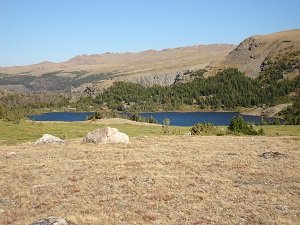
it seemed best to stop at Marion Lake; we had traveled 10 miles.
![]() |
| Marion Lake |
We enjoyed the view of the lake
long enough to eat, and then decided to head back (5:00 p.m.) and ride out as quickly as
possible. My brother put me in the lead so
that he and Chief Questionable Judgment could minimize any mishaps and get off the mountain before dark. We cruised/slid/bounced it out in an hour and
were back at the truck by 6:00 p.m. Yeehaw! Good
timing. Good scenery. Good weather. Good brakes. Good ride!!
We finished off the evening with good food, a meal at the famed Cowboy Café in Dubois.
Subscribe to:
Posts (Atom)


